呼吸の土地 – 流域水害の補足としてのランドスケープの提案
毛 月婷
Breathing land -Landscape as a supplement to regional disaster prevention for Yamato River Basin
Yueting Mao
- JP
- EN
呼吸の土地 – 流域水害の補足としてのランドスケープの提案
毛 月婷
Breathing land -Landscape as a supplement to regional disaster prevention for Yamato River Basin
Yueting Mao
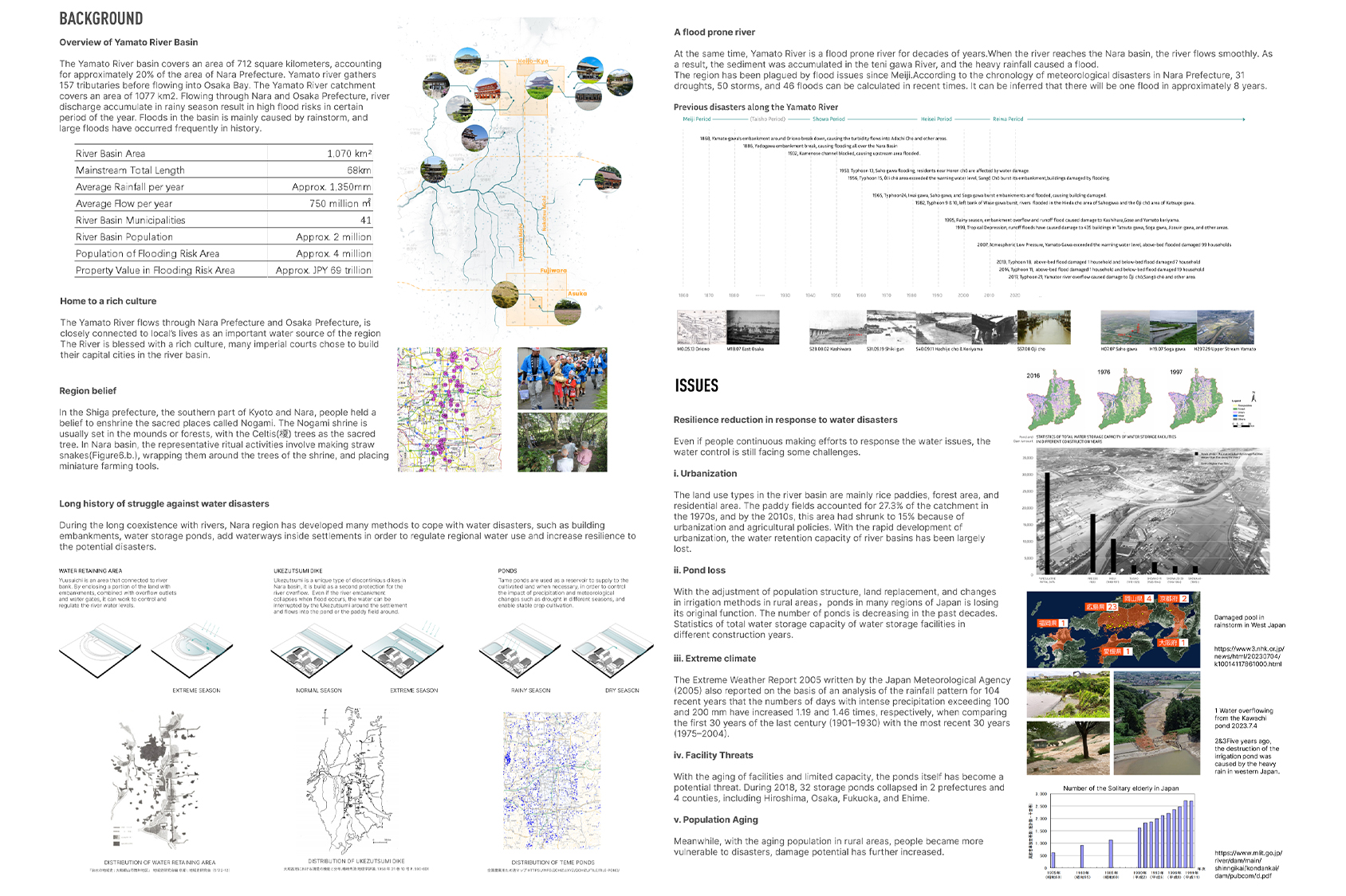
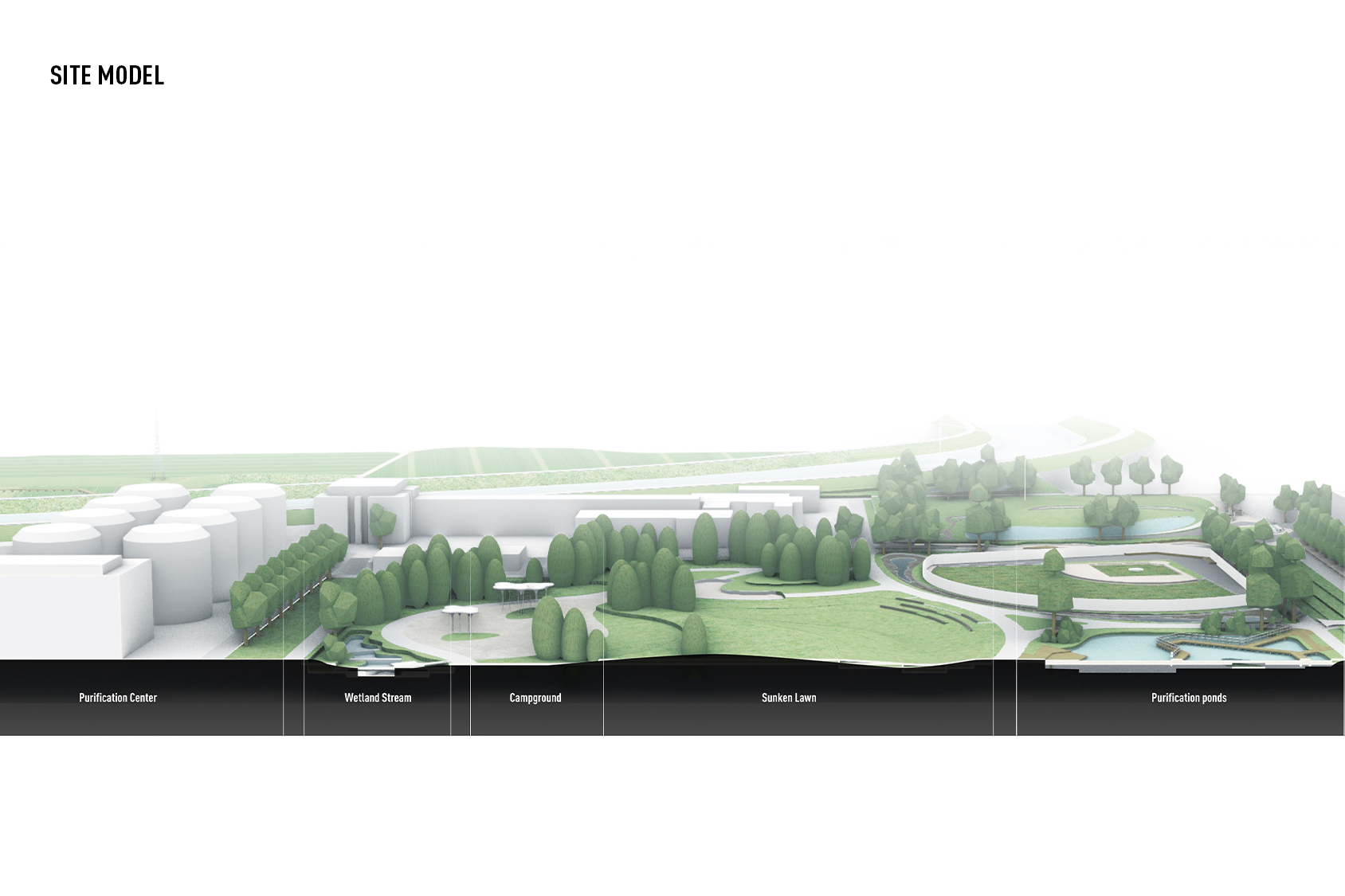
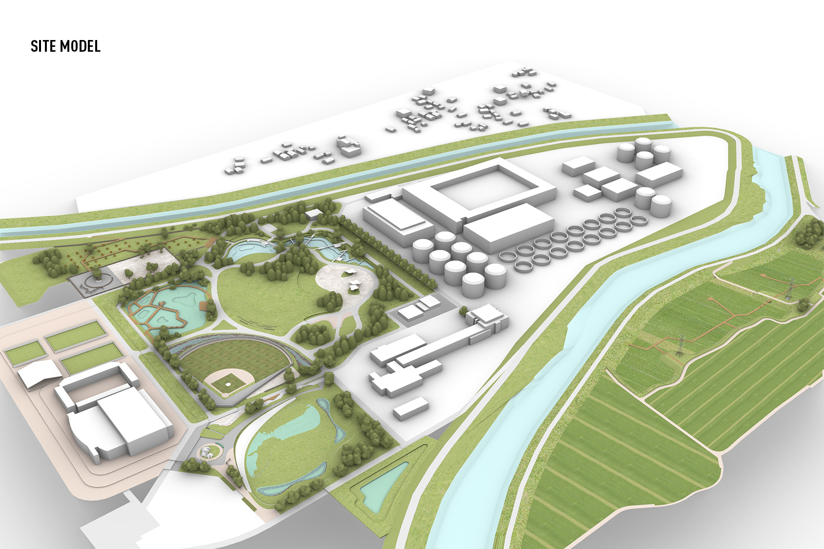
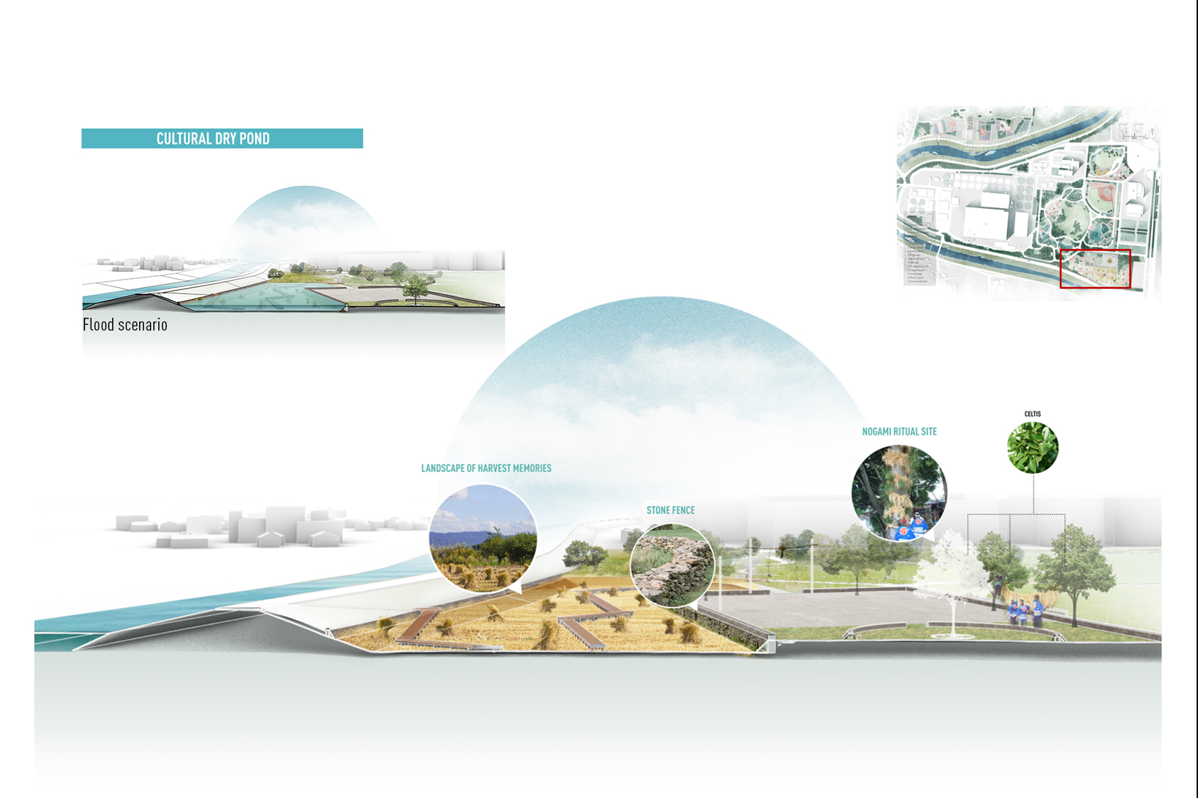
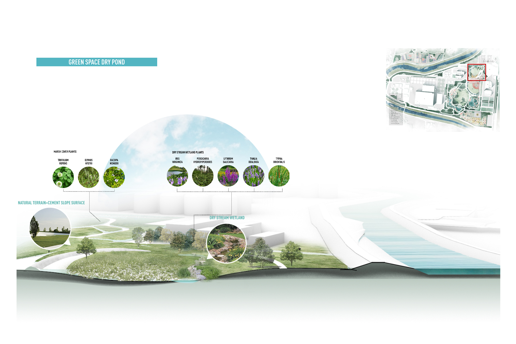
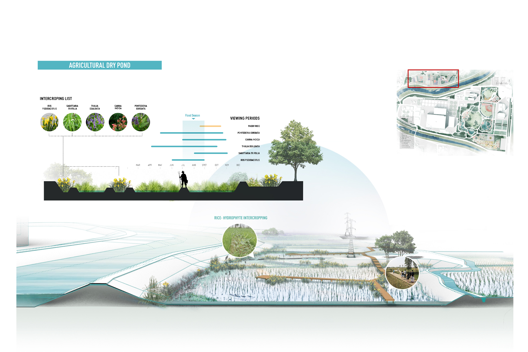
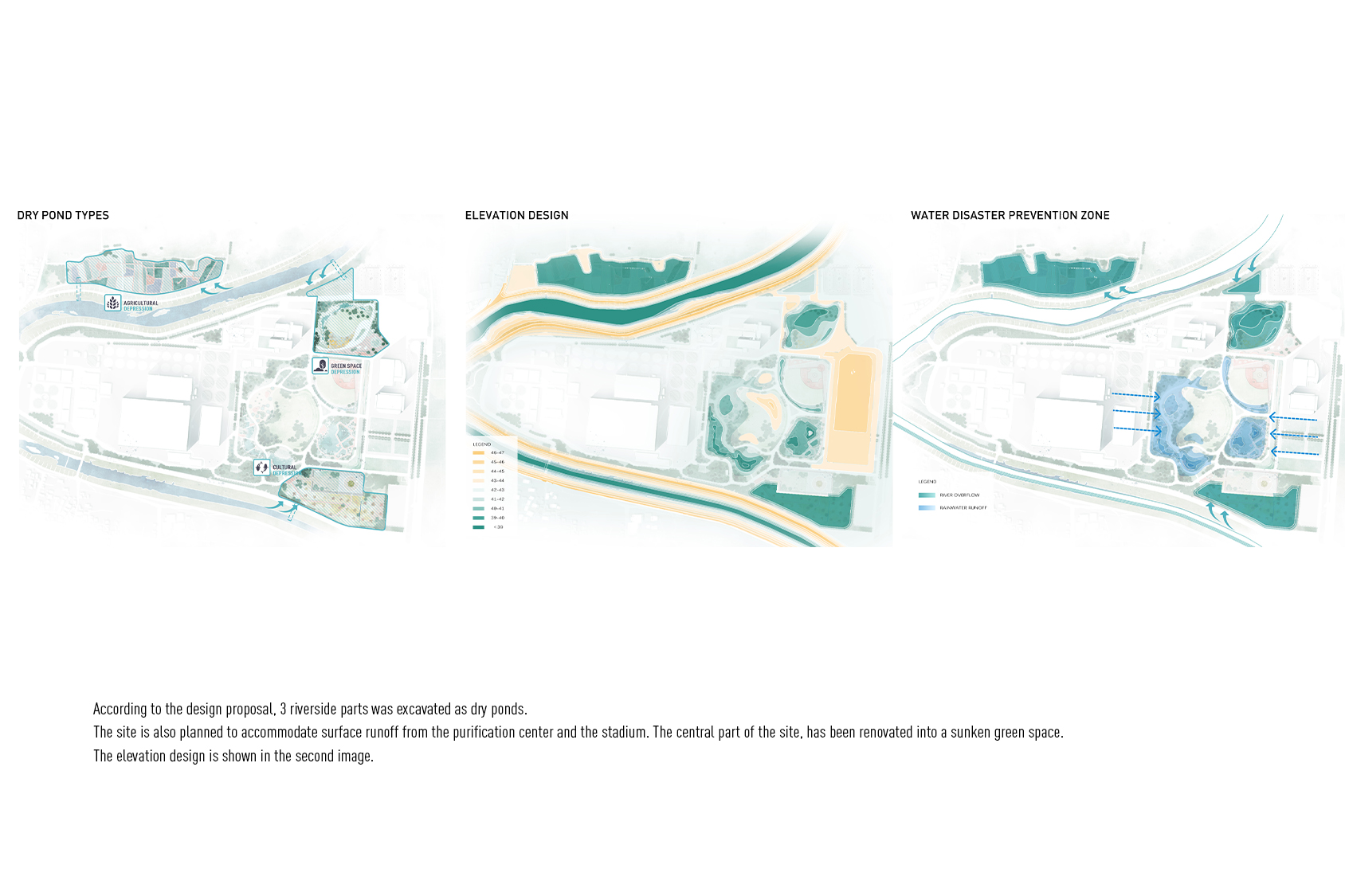
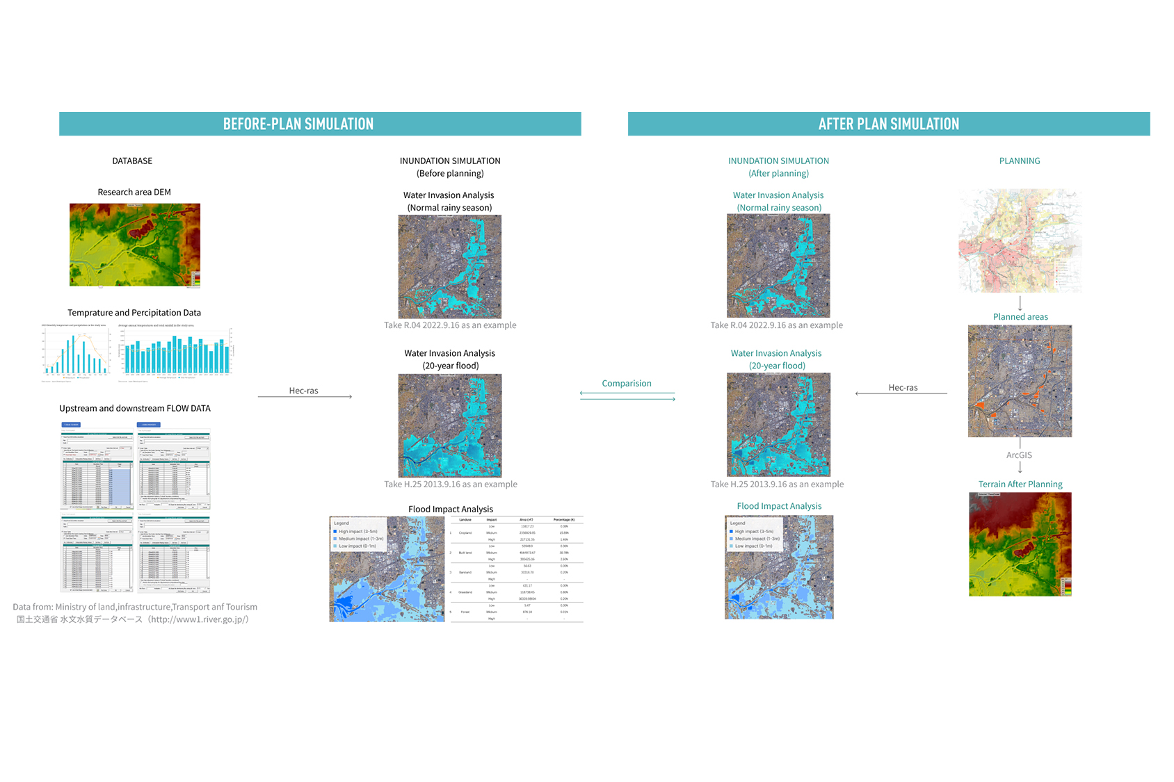
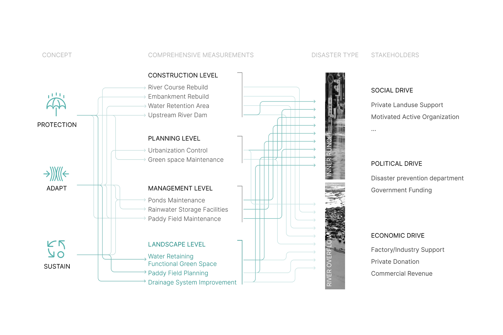
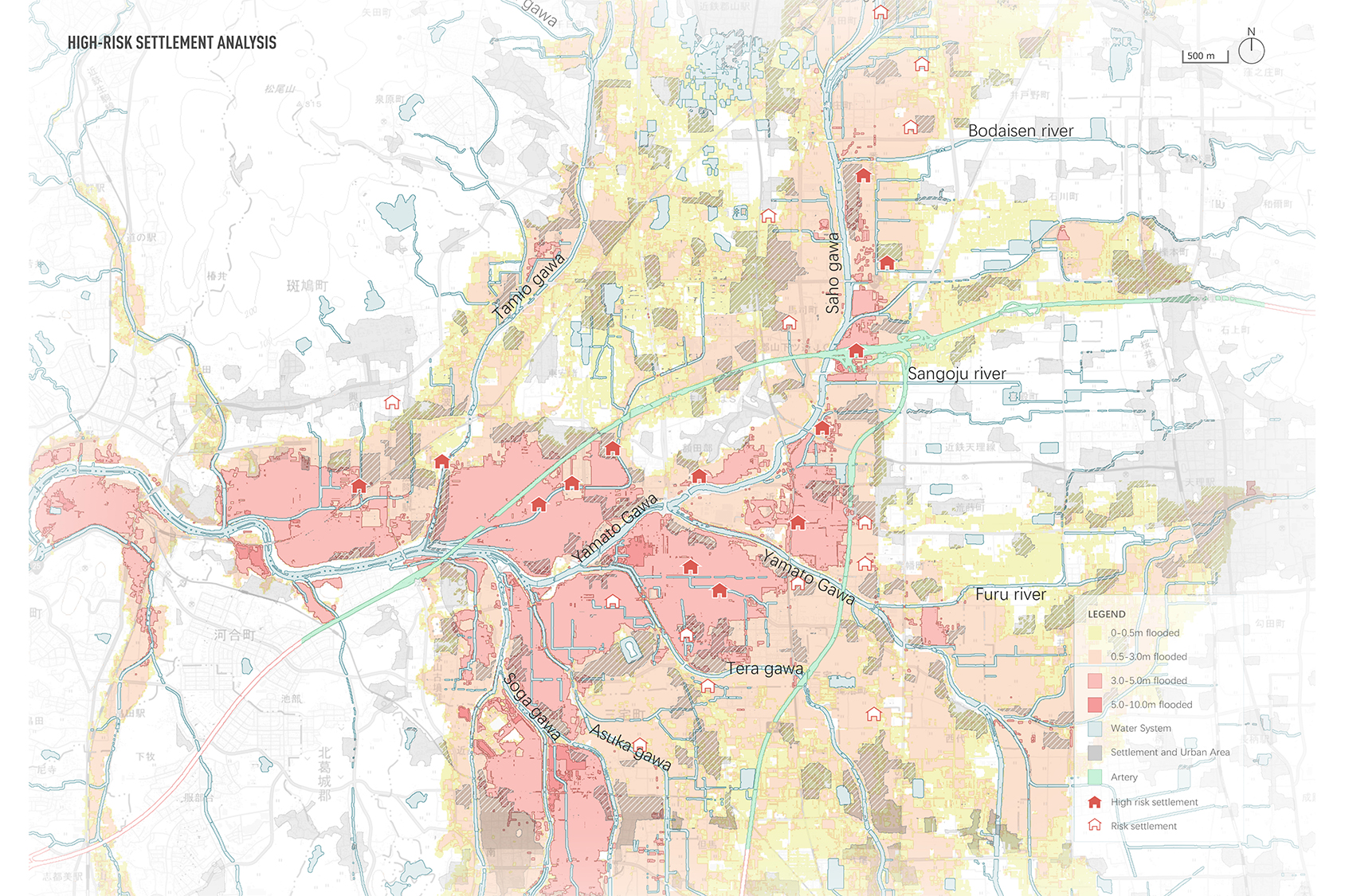
洪水は、あらゆるレベルで環境の不均衡を生み出し、流域の経済発展の損失につながる。調査地域である大和川流域は、気候変動と土地開発の結果として、長期にわたって洪水にさらされてきた。自然条件下では、土地そのものが増水した水域を取り込み、吸収し、放出する能力を持っており、湛水問題を軽減することができる。本設計は、土地の保水機能を発揮させ、積極的に窪地地形を構築し、自然を利用した解決策を提案するものである。提案の有効性は、Hec-rasによる歴史的洪水氾濫のシミュレーションによって検証されている。本アプローチは、景観の多面的機能の観点から実施されている。土地属性に応じた3つの窪地設計スキームを提案した。
Floods create environmental imbalance at all levels and lead to loss of economic development. The study area - Yamato River Basin has been exposed to floods over time as a result of climate change and land development. Under natural conditions, the land itself has the ability of capturing, absorbing, and releasing rising water bodies ,to reducing water logging problems. The design propose a nature-based solutions, by actively setting up depression terrains to exercise the water retention function of land and alleviate regional crises. The effectiveness of the proposal has been validated through the simulation of the history flood inundation in Hecras software. The approach is implemented through the perspectives of landscape multifunctionality. 3 design schemes for depression areas have been proposed for different land attributes.